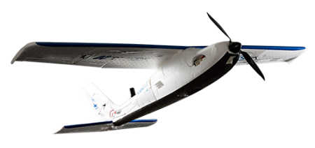
BASIC
- Upgradable by Software
- MAVinci Autopilot
- Topcon GNSS receiver
PRO+ INTEGRATED BASE
- Upgradable by Software
- MAVinci Autopilot
- Topcon GNSS receiver
- GPS/GLONASS/L1/L2 RTK
- 100Hz GPS update rate
- External base
- NTRIP
- Needs Topcon kit for integrated base
AERIAL PHOTOGRAMMETRY WITHOUT GCP’S
Save up to 50 percent of total project time and avoid ground control point establishment and positioning. GNSS RTK onboard the Sirius Pro provides accurate real time positioning of the UAS, so image capture locations are instant.
Post processing is simple, with wireless export of images and position data to processing software for creation of DTMs and orthomosaics. Easily calculate basic measurements, overlay 3D models for cut and fill analysis, and even create as-built design comparisons.
