SONY APLHA 7R*
- Full-frame photo camera with an image resolution of 36 MP
- It features 36 MP ISO 100-25.600
- 35 mm full-frame sensor
- No optical low pass filter
INSPECTION PAYLOAD
- Real-color, time-stamped, and georeferenced RGB and 14-bit RAW thermal images.
- Two cameras mounted in parallel on one gimbal
- Full sensor RGB camera
- FLIR Tau 2 640 camera
FLIGHT PLANNING SOFTWARE
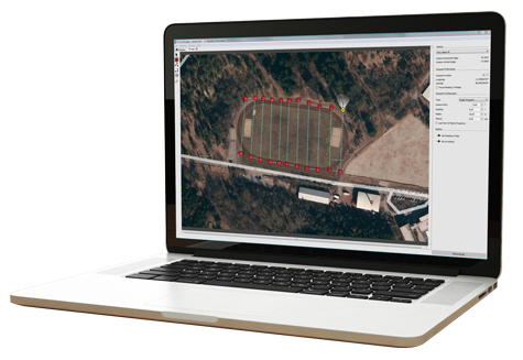
Proven software for easy-through-complex flight planning.
Navigator software helps you carry out challenging field projects quickly and easily. In just a few clicks you can plot matrices, define routes, and set all relevant system and camera parameters.
You can edit and exactly reproduce missions whenever you need to.
As part of the package, users receive:
Navigator waypoint flight planning software
Photo Tagger to combine logs with images for use in post-processing

CHOOSE FROM TWO DIFFERENT
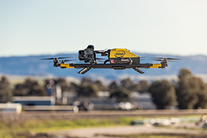
INTEL FALCON 8+ DRONE – TOPCON EDITION PAYLOAD OPTIONS

Survey & Mapping Package – ideal for surveying, modeling, and mapping projects. Quickly capture overall data for accurate 3D terrain modeling; building survey and construction progress; inventory analysis, vegetation control, and more.
Inspection & Monitoring Package – for industrial on-shore and off-shore inspection and monitoring.

